

Step 1
Requirements Analysis
Our services deliver measurable results
We use AI across planning, design, and development to reduce waste, speed up delivery, and improve quality, without increasing budgets.

We joined at the concept stage and supported the project from product definition through mobile app development and release.
Businesses that want to build additional digital services using their own data with real time notifications, dashboards, and user specific customization.
 Product Design
 Flutter Apps
 252
Views
252
Views

Thomas Kiess
CEO
KWMSys operates sensor systems for cities to measure river water levels and other environmental metrics.
This data was already collected and processed in the cloud, but access was limited to professional users.
The idea was to make this information available to a broader audience so that citizens could stay informed about flooding risks in real time. To strengthen the warning system, official German weather alerts from the DWD were integrated.
The challenge was not data availability, but using it efficiently and turning it into a public facing product that delivers clear, actionable information when it matters most.
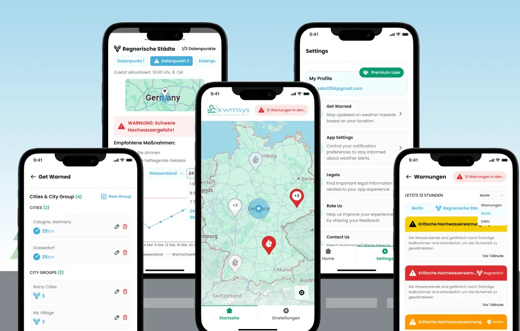
We built a mobile application that connects to the existing cloud infrastructure and visualizes live sensor and weather data in an interactive 2D map.
Users can select locations, subscribe to warning areas, and receive push notifications when critical thresholds are reached.
The app transforms complex IoT data streams into understandable warnings, enabling fast awareness and proactive response without requiring technical knowledge from users.
Step 1
Requirements Analysis
Step 2
Concept and Design
Step 3
Implementation
Step 4
Quality Assurance
Step 5
Deployment
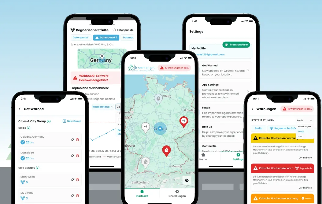
The core of the app is an interactive 2D map that visualizes live sensor data and weather warnings. Users can see affected areas at a glance, understand severity levels, and explore details for specific locations (data measuring points).
The map based approach makes complex data immediately understandable and actionable.
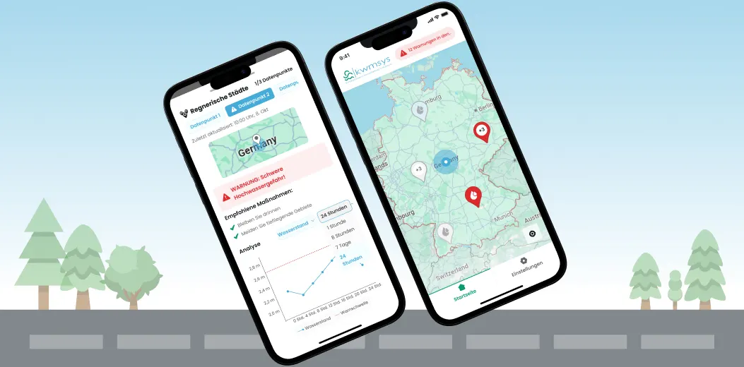
Users can subscribe to specific locations and warning types. When thresholds are exceeded or new alerts are issued, the app sends push notifications in real time.
This ensures users are informed immediately without actively monitoring data.
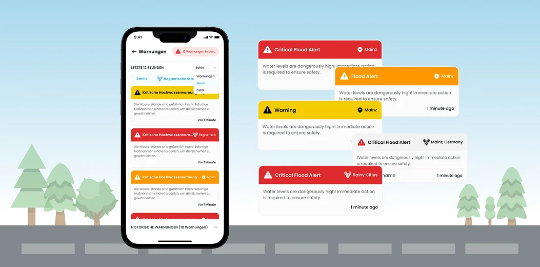
The app combines IoT sensor data from the client's cloud with official DWD weather warnings.
This creates a more reliable and comprehensive warning system than relying on a single data source.
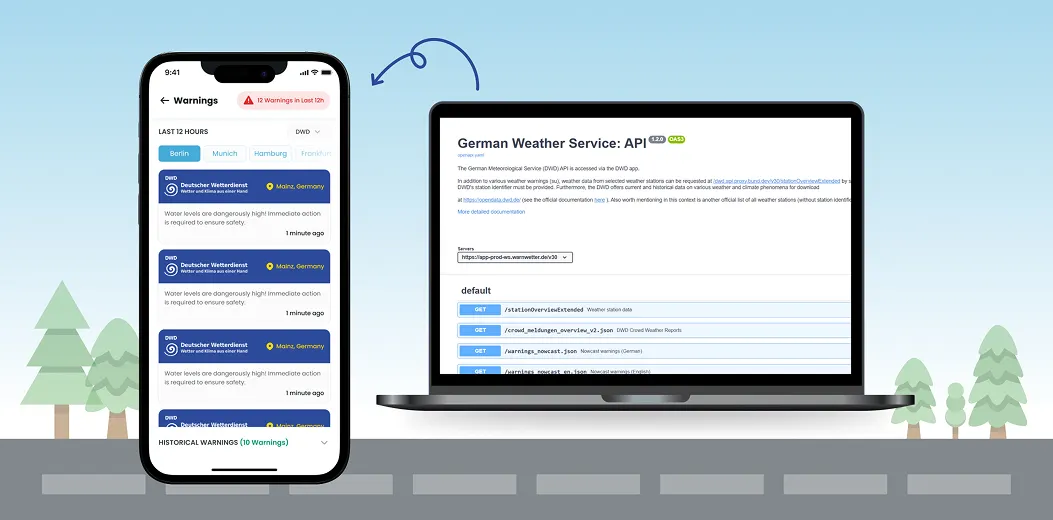
Users can customize which locations (data measuring points) and warning categories they want to follow.
This keeps notifications relevant and avoids alert fatigue while maintaining safety.
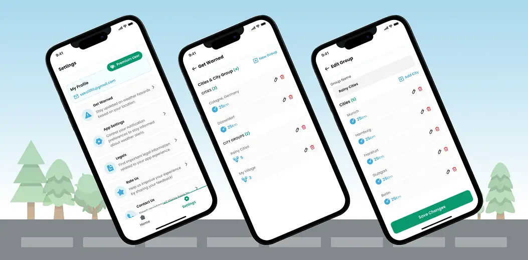
The main challenge was integrating a complex external backend without direct control over its development. Back-end availability was limited, and quick changes were often not possible.
To keep progress steady, we relied heavily on API mocking, clear interface definitions, and detailed documentation.
Aligning frontend and back-end expectations required structured communication and careful coordination to avoid blocking dependencies while maintaining product quality.
We learned that frontend and backend separation requires strict interface contracts and proactive documentation. Mock driven development keeps teams productive even with limited back-end access.
These learnings help partners manage distributed development setups more effectively. They reduce risk, improve predictability, and keep delivery timelines stable despite external dependencies.
If front-end and back-end are developed separately, define interfaces early and invest in mocking. It protects timelines and reduces coordination friction.
The most special part of this project was the vision behind it: transforming raw environmental data into a public safety product that anyone can use.
Making real time flood information accessible through a clear, intuitive UI required balancing responsibility, clarity, and trust.
Designing a map driven experience that surfaces relevant warnings instantly showed how data becomes truly valuable when it is presented in a way that empowers people to act.
 Thomas Kiess
CEO
5.0
Thomas Kiess
CEO
5.0
The team connected our existing cloud infrastructure to a user-friendly mobile experience without compromising quality. They translated complex data streams into actionable public warnings with care and precision. The collaboration felt professional, thoughtful, and aligned with our mission.
Every successful project leaves behind measurable results and a clear path forward.
The references below show how we work, what we deliver, and the outcomes our partners achieve with us.
 STRATEGY
 UI/UX
UI/UX
 SAAS
SAAS
 WEB DEVELOPMENT
PCapital - How a Cybersecurity Expert Became a Software Company
WEB DEVELOPMENT
PCapital - How a Cybersecurity Expert Became a Software Company
 Karoly Aczel
Founder & CEO, Perpetuum Capital Ltd.
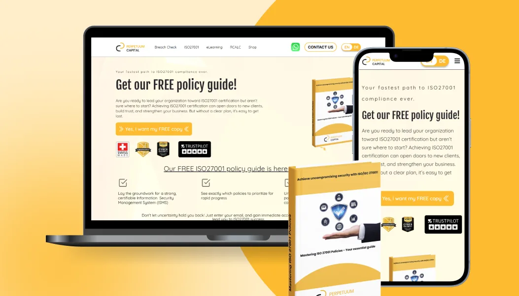
The founding team had years of hands-on ISO 27001 consulting experience and knew exactly what companies needed to get certified - but everything was delivered manually, one client at a time. The gap was clear: companies wanting ISO 27001 certification were either paying expensive consultants for work that could be structured into a guided tool, or they were lost in documentation without any support. The idea was to build two things that work together: a professional website that builds trust and sells digital products, and a SaaS application called Sentinel that guides organizations through ISO 27001 certification and ongoing ISMS management without needing a consultant in the room.
One-person consultancy → platform business
Use case
Karoly Aczel
Founder & CEO, Perpetuum Capital Ltd.
The founding team had years of hands-on ISO 27001 consulting experience and knew exactly what companies needed to get certified - but everything was delivered manually, one client at a time. The gap was clear: companies wanting ISO 27001 certification were either paying expensive consultants for work that could be structured into a guided tool, or they were lost in documentation without any support. The idea was to build two things that work together: a professional website that builds trust and sells digital products, and a SaaS application called Sentinel that guides organizations through ISO 27001 certification and ongoing ISMS management without needing a consultant in the room.
One-person consultancy → platform business
Use case
 STRATEGY
UI/UX
STRATEGY
UI/UX
 MARKETPLACE
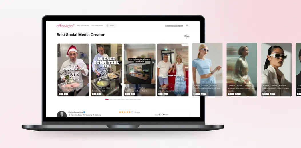
OfficeActor - End-to-End Influencer Booking Platform
Marlon B.
Founder & CEO, OfficeActor
Marlon B. saw a clear gap in the market: companies wanting to collaborate with influencers had no structured way to find, evaluate, and book them. Everything happened through DMs, spreadsheets, and informal agreements. At the same time, influencers had no professional tool to manage incoming requests, track contracts, or get paid reliably. The idea was to build a two-sided platform that gives both parties a clean, structured workflow - from discovery to signed contract to payment.
0 manual booking steps
Use case
MARKETPLACE
OfficeActor - End-to-End Influencer Booking Platform
Marlon B.
Founder & CEO, OfficeActor
Marlon B. saw a clear gap in the market: companies wanting to collaborate with influencers had no structured way to find, evaluate, and book them. Everything happened through DMs, spreadsheets, and informal agreements. At the same time, influencers had no professional tool to manage incoming requests, track contracts, or get paid reliably. The idea was to build a two-sided platform that gives both parties a clean, structured workflow - from discovery to signed contract to payment.
0 manual booking steps
Use case





 Behance


